Shaun Mackey (Archaeology)
Palimpsest noun
1. a parchment or the like from which writing has been partially or completely erased to make room for another text … [1]
This letter considers archaeological landscapes as a manuscript—a text written in the languages of soil and vegetation, topography, rock and ruin, fragments, sherds, the visible and the concealed. These dialects and the archives of documents, maps, and pictorial images, help us read and interpret the past. Archaeologists deal with the incomplete, studying these antique traces through a fractured lens that requires us to be detectives and time travellers. The clues are often in plain sight.
Next time you walk through the courtyard at CSEAS, look up at the library wall just before entering the Inamori Building. Notice the vertical shadow-line of bricks with its strange geometry of puckered cement covering those bricks near the height of the adjacent library window. There was once a boundary wall here that extended to the north. Exit the courtyard and continue through the Inamori foyer out into the street. Cross the road to the riverside and walk south. Observe how the roadway is a built-up embankment with pieces of building rubble eroding from the soil. This rubble includes brick types from the Meiji into early Showa eras (1869–circa. 1930s) and concrete: a twentieth century construction. These details exist within a broader context.
In Southeast Asia, the ancient monsoon empires of Pagan, Ayutthaya, Majapahit, Champa, the Đai Viet, and Angkor are obscured by forest, floodwater, and time. The scale of cultural features within these monumental landscapes—canals, reservoirs, embankments—stretch beyond the eyes capable reason to perceive.
In 1920s colonial French Indochina, researchers from the École française d’Extrême-Orient (EFEO) sought to overcome these obstacles with aircraft of the Armée de l’Air. Techniques of aerial photography, developed in the First World War, were applied to archaeological sites and landscapes. In Cambodia and Vietnam, Victor Goloubew and Jean-Yves Claeys used aerial photography to view Angkor, Tra Kieu and Oc-Eo. Another archive of aerial photographs, the William-Hunt Collection, stored in the Map Room of the CSEAS Library, were taken during the Second World War and beyond (1944–1947), with images that cover sites in Thailand, Cambodia and elsewhere.
Between 2013 and 2015, Dr Damian Evans conducted a series of airborne LiDAR surveys in Cambodia that revolutionized our understanding of the Angkorean landscape. LiDAR (light detection and ranging) is a method of using lasers to collect point clouds of data to create digital terrain models. It can strip away the vegetation to make the underlying topography visible. Across Cambodia, around 2230 km2 of data was collected. The Cambodia Archaeological LiDAR Initiative (CALI) and several other projects I was working for established a program of targeted survey and excavation incorporating these results.
The pioneer of aerial photography in archaeology, O. G. S. Crawford, referred to landscapes as palimpsests. Aerial photography and LiDAR maps expose features that overlap and entwine, devour and conceal, “partially or completely erased.” They show moments in time and echoes of the past.
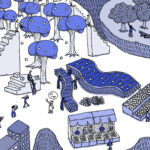
(Illustration by Atelier Epocha)
This article is also avairable in Japanese. >>
「歴史の痕跡」(ショーン・マッキー)


