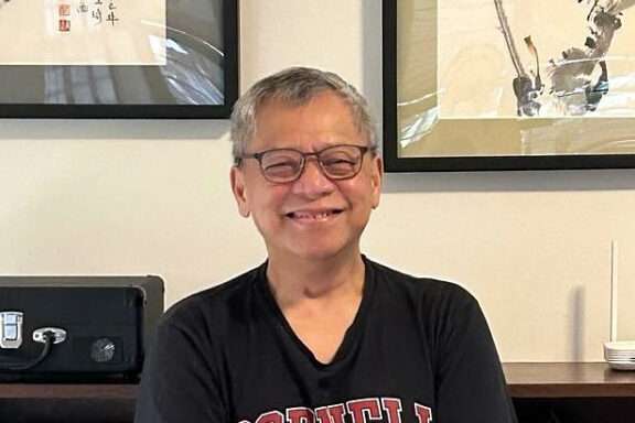
Interview with Mariko Ogawa

Short Bio
Mariko Ogawa is an Assistant Professor at the Center for Southeast Asian Studies, Kyoto University. While earning a PhD in Engineering from Kobe University and working at the university until 2019, she has been directly observing the particle size distribution of rain and snow in Japan to improve the accuracy of rainfall estimation using weather radar. Currently, she is mainly studying regional and seasonal characteristics of rainfall using weather radar in tropical peatlands of Indonesia, which stores a large amount of carbon in underground. She is exploring the utilization of hydrological and meteorological disaster prevention information to minimize the spread of peat fires and flood risks. Air pollution monitoring is also being conducted in the same area to investigate the effects of peatland fires and daily activities of local residents on air pollution.
In the tropical peatlands spreading over the swampy coastal areas of Southeast Asia, land reform (large-scale drainage) carried out since the 1990s has led to rapid development of acacia and oil palm plantations, resulting in forest degradation and desiccation (lowering of the groundwater table). During the prolonged dry seasons of the El Niño years, there were major wildfires caused by the burning of open fields and spontaneous combustion. The haze generated from the peatlands has caused serious health problems for local residents and economic losses due to poor visibility. CSEAS has been focusing on tropical peatlands since the 1970s, and for more than a decade has been working with local communities in Indonesia to conduct hydrometeorological monitoring and conserve the tropical peatlands. We interviewed one of the research team members, Assistant Professor Mariko Ogawa, who has sought to find solutions through hydrometeorology.
──Please tell us about your research, how you got started in the field and how you came to undertake your current project.
As a student in high school and university, I used to climb mountains and often experienced sudden changes in weather. These changes can be life-threatening at times so I think I was always sensitive to the weather. And I believe this is what got me interested in climate and nature.
I studied in the engineering department at university. My supervising professor had just been appointed to a newly opened meteorology laboratory and I was able to join him there. We released weather balloons in Okinawa and Hyogo prefectures to investigate the size, number and shape of raindrops and ice particles in clouds, as well as monitor atmospheric conditions. This provided valuable information contributing to a better understanding of the process by which clouds develop. We also studied how accurately we could estimate the volumes of ice particles and rain drops using weather radars. This kind of observation and research made me realize how fascinating it was to see things directly with my own eyes.
I had Indonesian friends while I was a graduate student, but I had never been to Indonesia until I joined my current workplace. My first two months were spent at our liaison office in Jakarta. I knew nothing about the language or culture. I remember when my predecessor first introduced me to the local staff, he told them to treat me like a three-year-old child.


For nearly 6 months since last fall I have been staying at the Jakarta liaison office. I am experiencing Jakarta weather first-hand. Since just after the Lunar New Year, we have had a string of days without rain. That, and the pollution from traffic exhaust, has made things dustier than usual.
Tropical peatlands carry both flood and fire risks. Indonesia, with its tropical rain forests just below the Equator, is particularly vulnerable to flooding when it rains in the swampy lowlands. The remains of trees and other plants accumulate in the moist soil without decomposing resulting in the spreading peatlands. It is common to hit upon dead tree trunks when digging through the peat.
The eastern coastal area of Sumatra, a region of spreading tropical peatlands, is remote and originally had few Indonesian Meteorological Agency observation stations. For more than 10 years, our research center has been carrying out hydrometeorological studies in the region. Rain gauge analyses told us that there were sometimes heavy rains after midnight in the coastal areas of eastern Sumatra. This kind of rain cycle characteristic of a maritime continent such as Indonesia is known to concentrate heavy rainfall along the coast.
Our field of research is the province of Riau in Sumatra. It comprises numerous islands, large and small, the island of Bengkalis, in particular, situated in a complex setting bordering the Malaysian Peninsula to the north and the island of Sumatra to the south. The daily rain cycle of the region is characterized by localized and moving rainfall. Weather radars sometimes show rainclouds distributed along the coastline. We are currently exploring how we can monitor rainfall in the peatlands, not only with conventional ground rain gauges, but also with weather radars that can observe the entire region, and how we can use information on fire, flood, and other hazards to benefit the lives of local residents.
In addition to weather radar data, we would like to understand which areas are more (or less) likely to have rain each day, and how rainfall varies by season, and to do this, we plan to visit local areas and develop applications that will allow residents to interactively transmit and receive local information. Our hope is that these activities will make possible earlier determination of fire risk and seasonal changes.
Currently, I am conducting research with the cooperation of local residents, focusing on rainfall to understand the aspects of fire risk and air pollution in tropical peatlands. Groundwater level thresholds for fire risk in tropical peatlands are also being studied by a number of researchers. Despite our field surveys to analyze the regional characteristics of groundwater level (and soil moisture contents), however, it is still quite difficult to understand (generalize) a relationship between fire risk and groundwater levels in whole areas (In fact, fires are often detected in satellite images of small island groups that are considered relatively wet).
The duration over which there is no continuous rainfall, on the other hand, is a good indicator of fire risk for a community. With the cooperation of local residents, we are taking measurements of such pollution indicators as PM2.5 and CO. In addition to particulate matter such as PM2.5, greenhouse gas emissions are a concern with fires. Additionally, peat’s propensity of incomplete combustion and the porous nature of peat soil can cause peat fires to smolder underground, making early detection and efforts to extinguish the fire difficult.
I would like to know how surrounding land use and atmospheric and meteorological conditions (wind, rain, etc.) affect air pollution here in the province of Riau. For example, air pollution conditions differ between urban areas and farming villages, and between heavily forested areas and areas with a lot of traffic. I would also like to examine how elements of daily activities, such as cooking or garbage incineration, may affect air pollution.

The danger is at its highest when there has been no rainfall for eight consecutive days.
──Tell us something about the people, things, and places you have encountered through your research.
We have installed air pollution sensors and rain gauges in about 10 houses in Riau to study the air pollution of the region and its relation to hydrometeorological conditions. I regularly visit these homes to collect data and carry out maintenance of the equipment. These visits have given me an opportunity to observe the lifestyles of the people in this region, where they make their homes, what kind of work they do, and how they live their daily lives. I am also learning something about how the local residents interact with the nature around them.

The head of this household collects harvested oil palm fruit and delivers the fruit to processing plants. Even dropped fruit can still be used. The bags in which the fruit is packed drip with oil.


This area is world famous for the large tidal waves that can be seen in the river during high tides and the rainy season. According to the residents of this house, the saltwater runup of the night before came up as high as the top of the stairs (left photo). They seem to know from experience when and how much water will come the next time. Here, I am explaining to some local people how to change the battery of the rain gauge (right photo).


In the first photo, the area is flooded to about a one-meter depth. I was told 60% to 70% of the local residents had left the area, but the people in this house on the banks of the Kampar River have stayed. The owner of this house manages a fish pond and came to pick us up in his own boat.

The husband of this household is a teacher at a religious elementary school. He made arrangements so that he could be at home when we visited. His wife also works, but at a different location and is often away from home. We were welcomed with sweet coffee and confections. In the foreground is a bowl of Tape Singkong, a confection made of fermented cassava.
──Please share with us some of the challenges you encountered and creative efforts you made in your fieldwork.
The cooperation of the local residents is essential for continuous monitoring of air pollution. They help us regularly check the instruments and let us know when there are power outages. We want the local people to get to know and accept us, and when we visit, we make sure to explain what we are trying to do. They will sense if we are tense about our task so we always try to act as normally as possible as we collect the data, making conversation and asking them about recent events such as a fire or rain.
I was not involved when the air pollution detection instruments were first set up, but have heard the local people were quite suspicious at first. After two or three visits, however, they are more comfortable with us and willing to chat about anything, from their own particular interests to stories of fire.
──What are your aspirations for the future?
I would like to strengthen our collaboration with local governments and residents on the use of hydrometeorological data. As I noted earlier, this is related to our work to develop a disaster app local residents can use for two-way information exchange.
This January, we were at last able to talk with the people in the local administration’s disaster management division. They wanted to know not only about fires, but also weather forecasts, flood locations, saltwater runup, and more for every village. It was made clear to us that they needed to monitor events in as much detail as possible. For example, heavy rainfall around the end of last year caused considerable flooding damage in various parts of Riau, but they were not able to identify the flooding sites until the next day.
Hereafter, through seminars, training, and interviews, we hope to learn more about the needs and problems of local residents and governments in each region, and work together with them on the uses of hydrometeorological data.


The photo on the left shows a traffic jam on a flooded road. This is in a remote area far away from urban centers and it took us some time to grasp what was happening. We stopped to ask people along the way and tried to learn what was happening through social media. We found out later that in some places traffic was stopped for more than half the day. The photo on the right shows a boy fishing in the flood waters. Most shops had to close due to underfloor flooding.


(2 March 2024)